|
|
|
Satellite Map
Click on the areas you are interrested in for Accommodations and Information
Island Areas
|
|
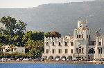
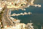
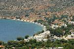
Rhodes | Official Website: www.rhodes.gr•Population:120.000 •Size:1400km 2 •Airport:Yes   | 
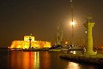
| Rhodes has a rich history and throughout the centuries, it has always been a prime location due to the excellent weather, scenery and climate. It has many well-preserved monuments for unlimited sightseeing, which range from the Ancient times (Kamiros, Lindos , Ialyssos, Rhodes ) to the Medieval ( Knights Castle , Old Town) and finally to current times (Italian occupation architectural heaven). There are many picturesque villages that are examples of current local history and where the local produce, a key ingredient in Mediterranean cuisine are grown. MORE Info & Photos of Rhodes Island
|
|
Karpathos | Official Website: www.karpathos.gr•Population:6.620 •Size:300km 2 •Airport:Yes | | Karpathos is the second largest island in the Dodekanese – after Rhodes. It is situated between Crete and Rhodes, in the ''Karpathian Sea''. The location of the island is strategic since it is the natural bridge which unites Crete with Asia Minor. MORE Info & Photos of Karpathos Island
|
|
Kos | Official Website: www.kos.gr•Population:26.379 •Size:288km 2 •Airport:Yes |
| Kos is a beautiful Greek island, which is located in the southeastern part of the Aegean Sea, in the Dodecanese islands. It is the third island in sequence in regards to area following Rhodes and Karpathos. MORE Info & Photos of Kos Island
|
|
Kalimnos | Official Website: www.kalymnos.gr•Population:17.066 •Size:111km 2 •Airport:Yes |
| Close to Kos island, Kalimnos is a small island but infamous through its large number of immigrants throughout the world.
Famous for the sponges and for the excellent Rock Climbing, it attracts more and more visitors every year. MORE Info & Photos of Kalimnos Island
|
|
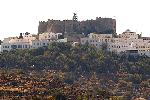
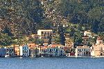
Astypalaia | Official Website: www.astypalaia.gr•Population:1.113 •Size:97km 2 •Airport:Yes | | Until the 19th century, Chora was the only settlement of the contemporary years of Astypalaia. The other settlements which exist today were created in the uncultivated spots of the island.
The biggest of these settlements are Livadi and Analypsi or Maltezana, created during the Italian years. Most of the islands life is concentrated in Chora. It is built on a peninsula which is bathed by the serene sea creating two tranquil bays called Pera Yalos which is situated on the left as we look at the open sea and Livadi which is on the right. The Venetian Castle, with its two whitewashed churches, stands proudly at the top of the peninsula proclaiming the onset of the development of the settlement. MORE Info & Photos of Astypalaia Island
|
|
Kasos | Official Website: www.kasos.gr•Population:1.088 •Size:64km 2 •Airport:Yes | | Kasos is located in the southernmost region of the Eastern Aegean and lies between Crete and Karpathos. It has an area of 64 square kms and a population of 1088 people.
The land is mountainous and rocky with few areas suitable for agriculture. The visitor to the mountains of the island will find rare wildflowers and birds species. Kasos has a mild, healthy climate.
MORE Info & Photos of Kasos Island
|
|
Tilos | Official Website: www.tilos.gr•Population:535 •Size:61km 2 •Airport:No |
| Tilos is located at the north west of Rhodes Island, surrounded by high and rocky mountains, steep coasts, beaches with transparent waters and caves.
It has to offer Medieval castles, a Byzantine monastery, many small graphical churches and a village that is a declared cultural monument. You may visit the cave full of paleontological discoveries like the famous dwarf elephant fossil bones. MORE Info & Photos of Tilos Island
|
|
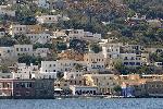
Symi | Official Website: www.symi.gr•Population:2.560 •Size:58km 2 •Airport:No |
| Symi belongs to the Dodecanese islands complex and lies 24 nautical miles NW of Rhodes and 255 nautical miles from the port of Piraeus. The highest point is Mountain Vigla at 616 metres. The island is very close to the coast of Asia Minor, just 5 miles from Alopos. It is not a very big island, only 58,1 square kilometres. The majority of the land is covered in rocks. MORE Info & Photos of Symi Island
|
|
Leros | Official Website: www.leros.gr•Population:8.500 •Size:54km 2 •Airport:Yes |
| Leros, or the Island of Artemis, of the untouched natural beauty and the endless harmony…
Visit our island where you have the feeling that time flows in other rhythm. Away from the popular and busy tourist destinations, you will live an unforgettable experience, because even today, life in Leros is a true and authentic experience.
MORE Info & Photos of Leros Island
|
|
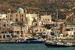
Nisiros | Official Website: www.nisyros.gr•Population:940 •Size:41km 2 •Airport:No | | The unique Green volcanic island located in the South Eastern part of the Aegean Sea in an extent of 41.6 sq. km, with a coastline extending on 25 kilometers and with Profitis Elias located at a height of 698 meters. MORE Info & Photos of Nisiros Island
|
|
Patmos | Official Website: www.patmos.gr•Population:2.990 •Size:34km 2 •Airport:No |
| Patmos, the island of Greek Archipelago, that became worldwide acquaintance from the Revelation of Ioannis, is a place that it distinguishes.
This particularity lies that it combines the historicity and the religiosity of space with the ideal place that offers in the visitor for relaxation and quiet vacations.
The rich history, the Byzantine tradition of many centuries, the natural environment, the traditional architecture of the settlements, the excellent microclimate, the hospitable disposal of the residents, are certain some of the reasons that travelers prefer Patmos.
MORE Info & Photos of Patmos Island
|
|
Halki |
•Population:421 •Size:28km2 •Airport:No
|
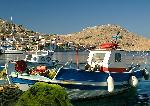
| Halki is knowed through out the world as 'The Center of Peace and Friendship'.
Young people from all over the world organise every summer cultural events and musical events at the island.
Halki is a mountainous island, to the west of Rhodes and it's not far away from Kamiros Skala (port of Rhodes), about 3.5 nautical miles. MORE Info & Photos of Halki Island
|
|
Lipsi |
•Population:700 •Size:21km2 •Airport:No
|
| Lipsi is a group of islands in the Southeast Aegean, they lie North of Leros and East of Patmos.
Around Lipsi lie 24 smaller mostly uninhabited islands with many pristine beaches. The village of Lipsi lies approximately in the centre of the island with its harbour located in a scenic bay.
Lipsi is famous for its beautiful beaches, fine seafood and local dishes, the island also produces local agricultural products including meats, fruits,vegetables, cheeses, wines, honey etc. MORE Info & Photos of Lipsi Island
|
|
Agathonisi |
•Population:100 •Size:13km2 •Airport:No
| | One of the Untouched Greek islands by time and tourism. Here, you'll find the genuine and traditional Greece. Agathonisi is a tiny island, quiet and peaceful , almost traffic free. MORE Info & Photos of Agathonisi Island
|
|
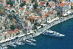
Megisti | Official Website: www.megisti.gr•Population:275 •Size:9km 2 •Airport:Yes |
| Kastellorizo or Megisti as the island is officially known since ancient times, is situated on the southern easternmost part of Greece. Its total surface is 9,2 sq. kms. and it lies 72 miles east of the island of Rhodes and only 2 kms from the Turkish coastline. It is a mountainous island and it belongs to the Dodecanese islands complex. MORE Info & Photos of Megisti Island
|
|
|
The Union of Tourist Family Accommodations of Rhodes - PRETOMA
Office: 69A Stratigou Zisi Str - Rhodes 85100 - Greece - Tel: +30 22410 30842
design & development
BrainSoft Software
• website / location photography by
GreecePhotoBank
website main sponsor: motostop.gr - a complete motorcycle catalog
|